The forgotten history of highway photologs
On May 10, 1985, a tricked-out van drove south on US Route 1 in Pawcatuck, Connecticut, on a sunny spring day. Every .01 miles, a 35-millimeter movie camera mounted on the dashboard captured an image out of the front of the van, along with a digital readout displaying the date, route, mileage, and bearing.
Highway departments in almost every state had such “photolog” programs, some dating back as far as 1961. Each year, these vans would drive thousands of miles of state roadways in both directions. States ran these programs because they wanted an up-to-date visual record of each section of road, intersection, overpass, and bridge. The effort also captured some beautiful scenes from the past, featuring long-closed shops, hilariously low gas prices, classic cars, and often people just walking by the side of the road.
In addition to helping with infrastructure planning and maintenance, these data sets proved useful in defending the state against legal claims involving accidents on state roads. Photolog imagery provided a clear historical record for the courts, showing the placement of signs, curbs, crosswalks, and other traffic-control devices.
Today, many states have retired these customized data-collection vans; the work has been outsourced to third parties, and ubiquitous online mapping providers make such efforts seem antiquated.
But many states’ highway departments still have shelves full of old footage, a lot of it on 35-millimeter film and laser discs. I made a public records request to Connecticut’s Department of Highways to get access to this archival footage, which had been digitized at a fairly low resolution.
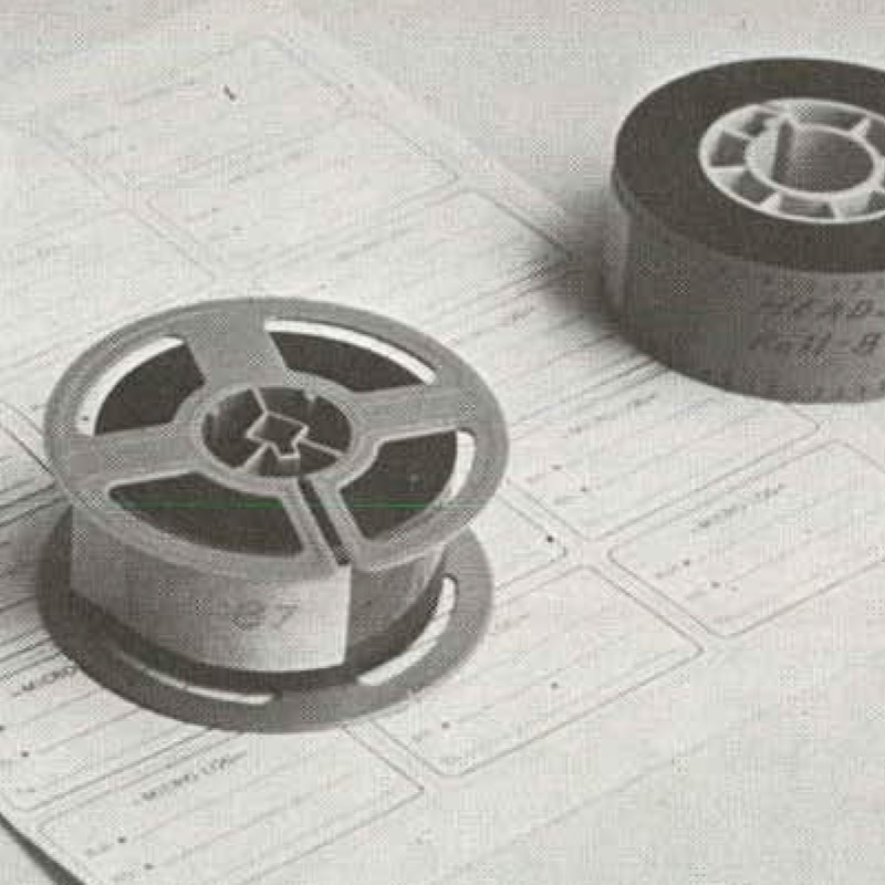
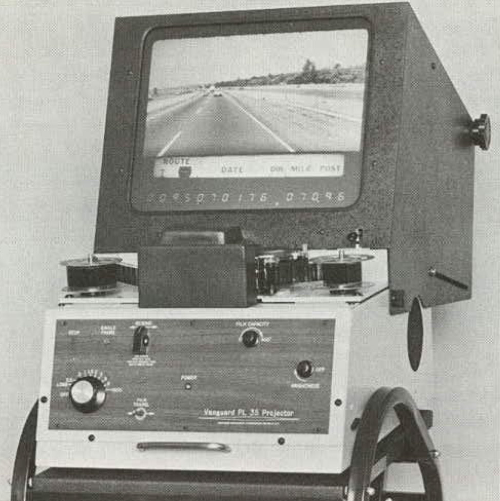
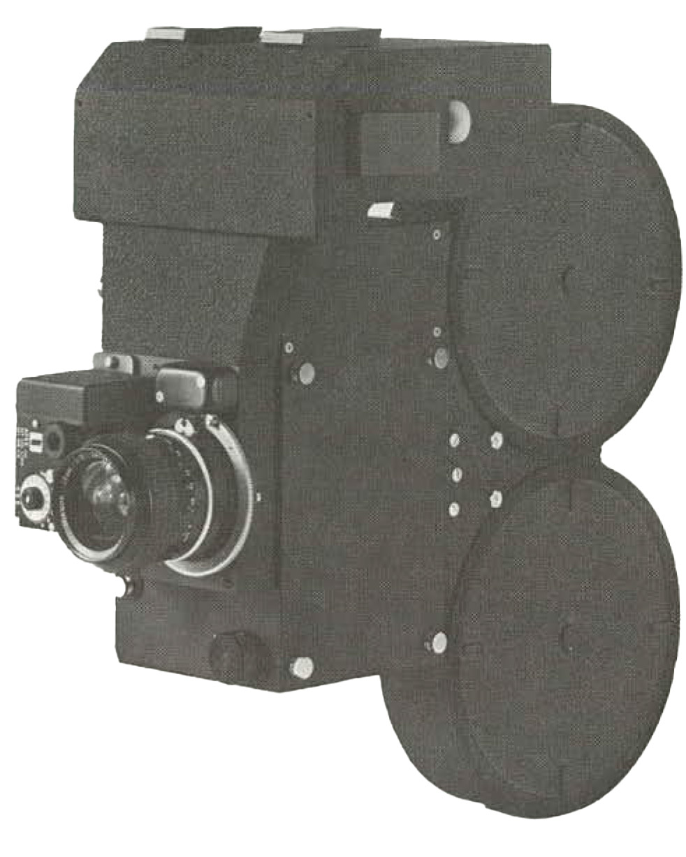
Reels of 35millimeter footage could be played back on a stopmotion analyzer.
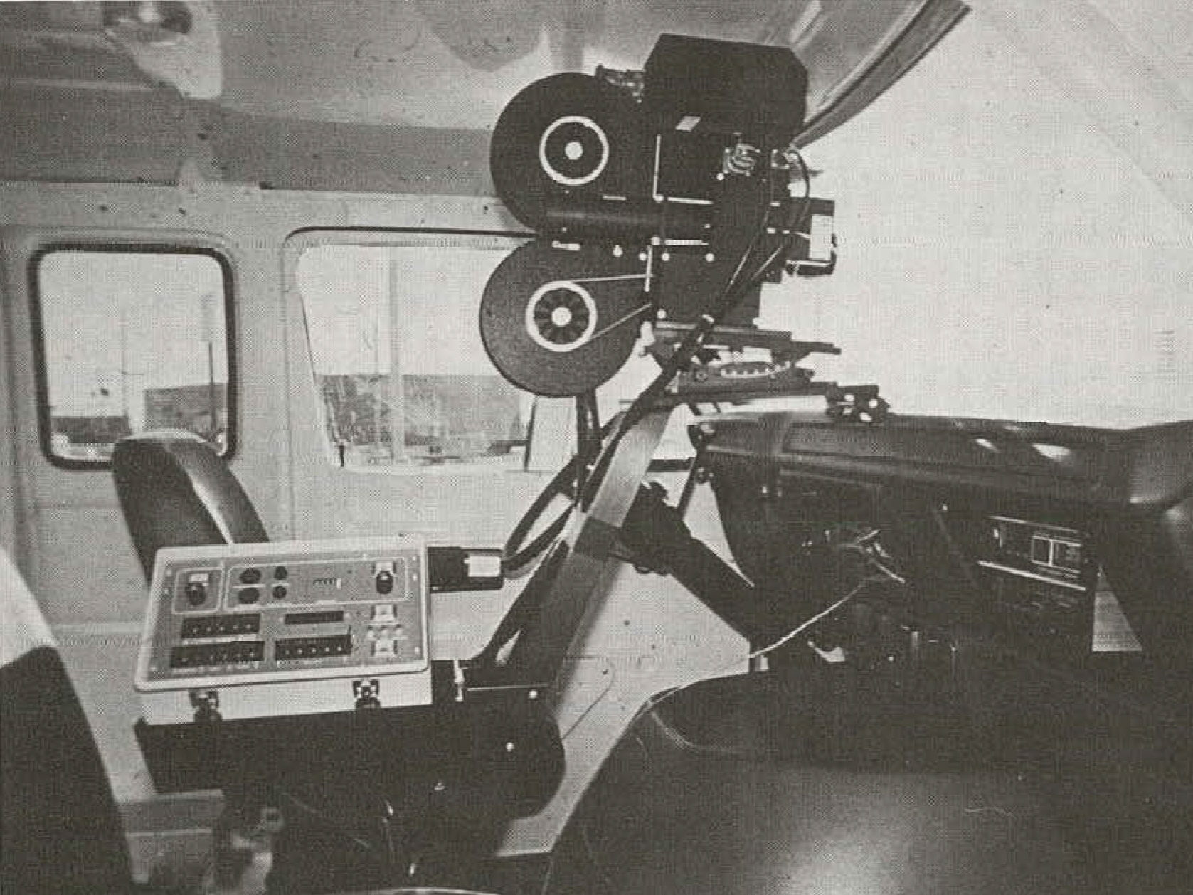
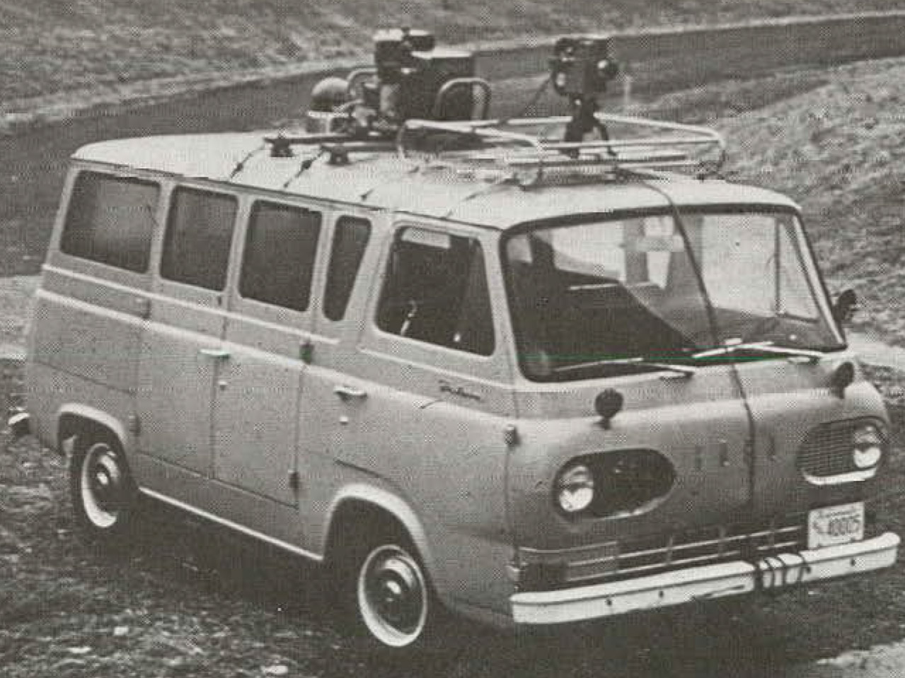
recording equipment in a van

Photolog controller for camera and display; automatic exposure control unit.
Over the years, such data-collection runs added side and rear cameras. They were further modernized with detailed 3D scans of the actual road surface, and with higher-resolution cameras. Starting in 2017, Utah’s Department of Transportation set out to record not just pictures of the roads, buildings, cliffs, and utility poles on the sides of the roadway but the actual geometry of the objects, using vans equipped with dual 360-degree lidar sensors. A public portal developed by Utah’s Department of Transportation uses colorful visualizations of this 3D data to let you virtually drive any major route in the state. Other states, such as Pennsylvania, also have web-based portals that let the public browse their more recent photolog data sets.
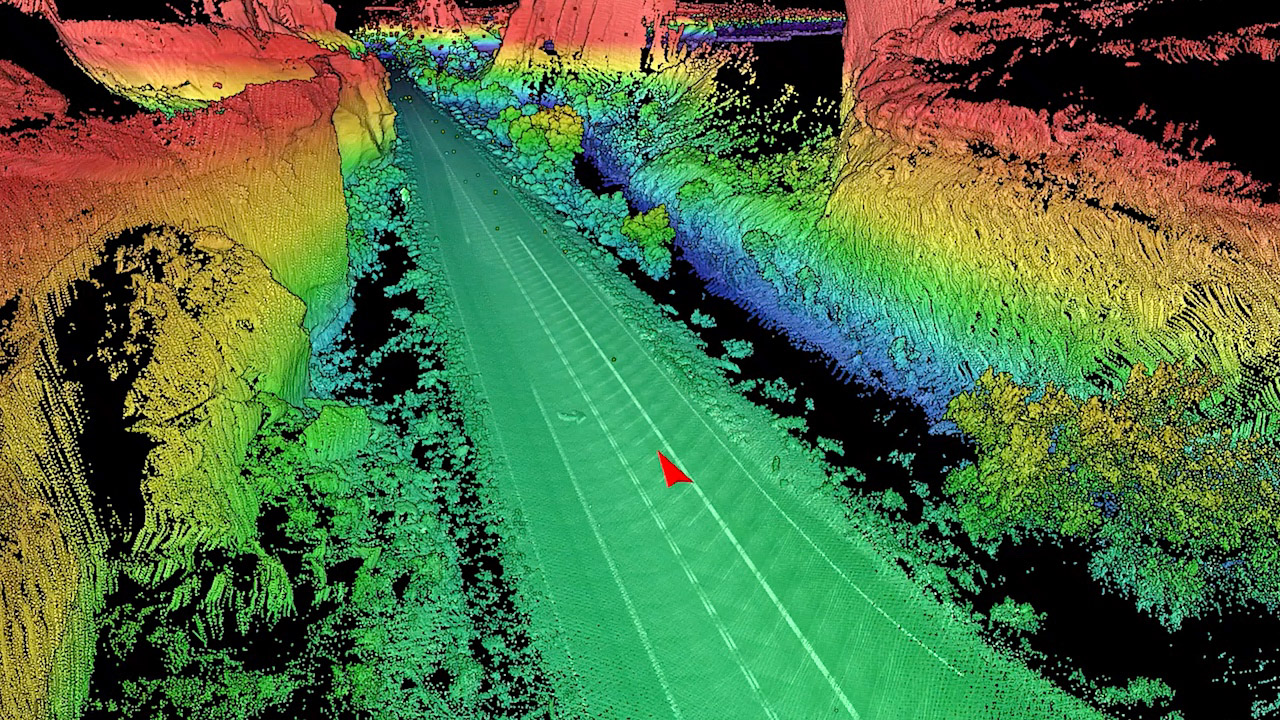
include dual 360degree
lidar sensors
capturing detailed 3D scans of the roads and
surrounding area.
These millions of frames of film are little snapshots of the roads we drove in the past, now sitting on dusty shelves in state archives. If more states digitized and published them, a wealth of valuable history could be preserved.
A version of this story appeared on Beautiful Public Data (beautifulpublicdata.com), a newsletter curated by Jon Keegan.